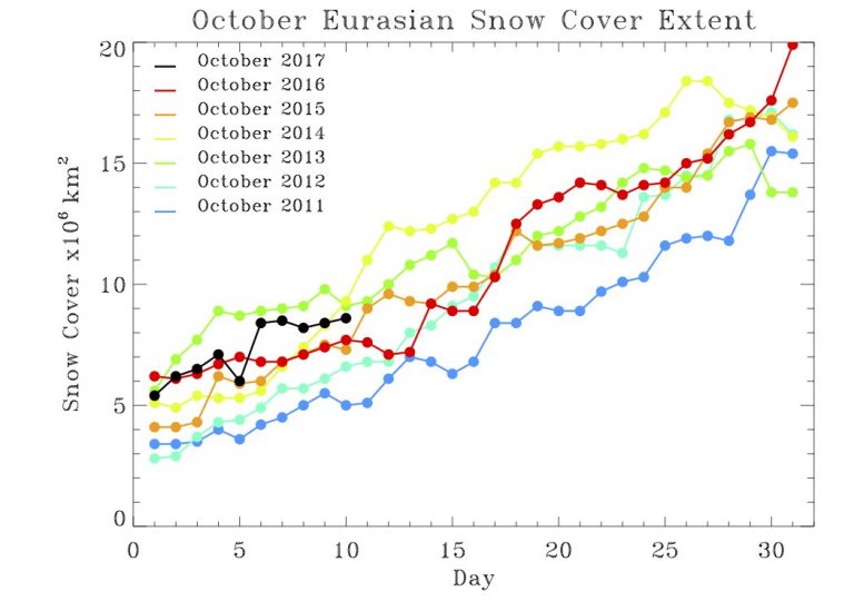
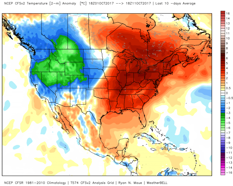
At long last, the pattern is signaling a transition to the cold season. Siberian snow cover is expanding as expected, extreme October warmth is on the wane, and some of the more semi-permanent low pressure systems in the Northern Hemisphere – the Aleutian Low in particular – are becoming established.
While the Siberian snow cover is not at a record-setting pace, it is ahead of recent years.

Why are we focused on the snow in Siberia? Climate research by Dr. Judah Cohen argues that deep, late-autumn snow in Siberia can act to fragment the Polar Vortex and send arctic air into the Lower 48. This comes at the expense of warming near the poles, however, which could open up opportunities for warm spells throughout the winter.
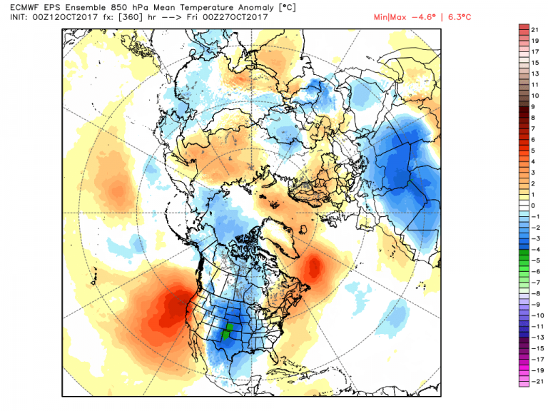
In the near term, model trends are indicating a cooler pattern into late October/early November for the Lower 48. This after a blistering start to the month of October in the East.

The problem, of course, is timing the shift to cooler temperatures – and the duration of the cold. Often, I will focus on the climate controls – The Southern Oscillation (SO – El Nino/La Nina), the evolving Arctic Oscillation (AO), Atmospheric Angular Momentum (AAM) a measure of how fast the atmosphere is spinning relative to Earth, and the Madden Julian Oscillation (MJO).
The SO is clearly positioned in a weak La Nina, something I’ve blogged about in previous weeks. Meantime, the AO is still evolving as a player in the upcoming winter pattern – driven by several ocean-atmosphere interactions. That leaves the AAM and the MJO as the driving forces behind the next several weeks.
AAM is shifting to a positive state in the coming weeks, one that is favorable for colder outbreaks into the Upper Plains and Midwest. The MJO, in the meantime, will be shifting to a phase that also allows for colder temperatures into the Upper Plains. Combined, they make a compelling argument for a cold blast into the middle of the Lower 48 in the coming weeks – likely before Halloween if the models are correct.

Of course, this being mid autumn, the cold won’t hold for long. Model projections show this cold blob moving east and running out of steam in early November. Certainly too early for permanent, sustainable cold, but a strong signal that we are tiptoeing into winter.
