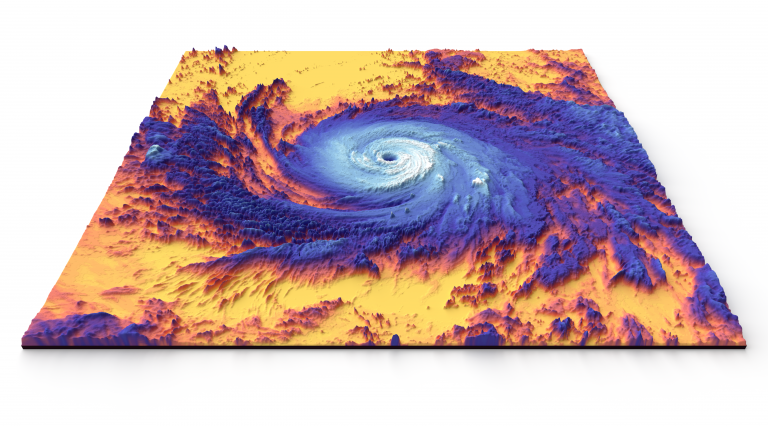
The weather in the Western Hemisphere has been dominated by activity in the tropics. In the Caribbean and Western Atlantic, the headlines have all blared about Jose and Maria, two powerful hurricanes that are now on the downswing. Heartbreaking accounts of Maria’s wrath are pouring in from Puerto Rico after she lashed the island on Tuesday. Maria cracked the top ten for lowest pressure in an Atlantic hurricane just as she peaked at a category 5 before coming ashore in St. Croix and Puerto Rico. Here is the 3-d satellite showing the distinct eye and symmetrical eye wall:
Jose, once a powerful hurricane, is now limping along off Long Island and Southeast Massachusetts as a weak tropical storm. It may pester Southeast New England and New York with gusty wind and light rain through the early part of the weekend as it slowly decays in the colder waters of the North Atlantic.
So what implications do these tropical systems have for the upcoming long range forecast? Oddly, very little. Without recurving into the high latitudes, there is nothing to significantly alter the jet stream and switch up the pattern. Maria may have an impact later next week or the following week, but its turn to the high latitudes near Newfoundland will only reinforce what was baked into the pattern a week ago: a warm surge into Western North America and a cool surge into Eastern North America.
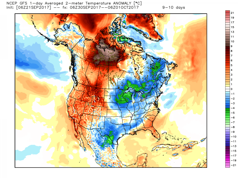
Note the huge pool of warmth over the Northwest Territories and Nunavut. This crazy heat is a consequence of the cold lobbing over Siberia in the coming weeks. Judah Cohen of AER in Lexington, Mass. addressed this in his weekly blog.
“The predicted negative AO (Arctic Oscillation) in the coming two weeks is a result of predicted strong high latitude blocking with the dominant block predicted to reside in the region of Scandinavia and the Barents-Kara seas. In the near term this will lead to a cold and snowy period across most of Siberia.”
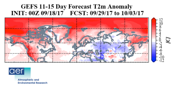
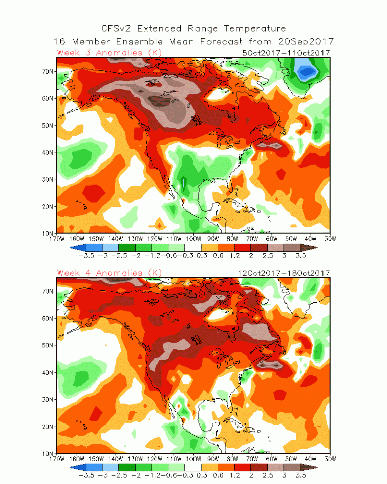
This is key to the balance of cold across North America. With limited amounts of available in the early part of the autumn season and developing high latitude blocking (due to global warming), the focus of the cold in Siberia allows the northern latitudes of North America to warm. Occasional cool intrusions are possible into mid October, but the overall theme is above normal temperatures. This is confirmed by the GFS week 3 & 4 forecast:
In the meantime, signs of an emerging La Nina are evident in the tropical sea surface temperatures (SSTs).
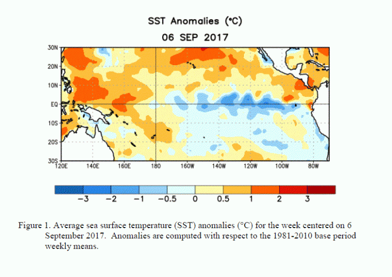
The blue shading shows the waters of the Central and Eastern Pacific are cooling. If this trend continues, it would bolster the idea of a warmer than normal winter across the Lower 48. I’ll caution that the jury is still out on this, and the winter pattern is hardly a lock this far out. That said, many of the weather models are pointing toward a moderate La Nina evolving in the coming months.
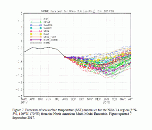
We’ll be reading the tea leaves very closely in the coming weeks as we journey through the first part of autumn.
